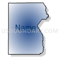
Tooele & Box Elder Counties PUMA, Utah
About
Outline

Summary
| Unique Area Identifier | 194244 |
| Name | Tooele & Box Elder Counties PUMA |
| State | Utah |
| Area (square miles) | 14,015.40 |
| Land Area (square miles) | 12,686.90 |
| Water Area (square miles) | 1,328.49 |
| % of Land Area | 90.52 |
| % of Water Area | 9.48 |
| Latitude of the Internal Point | 40.92950730 |
| Longtitude of the Internal Point | -113.06533350 |
Maps
Graphs
Select a template below for downloading or customizing gragh for Tooele & Box Elder Counties PUMA, Utah


Neighbors
Neighoring Public Use Microdata Area (by Name) Neighboring Public Use Microdata Area on the Map
- Cache, Summit, Morgan & Rich Counties PUMA, UT
- Davis County (North)--Layton, Clearfield, Kaysville, Syracuse & Clinton Cities PUMA, UT
- Rural Nevada PUMA, NV
- Salt Lake County (Northwest)--Salt Lake City (West), West Valley City (West) & Magna PUMA, UT
- Salt Lake County--West Jordan (West), Herriman & South Jordan (West) Cities PUMA, UT
- Southeast Idaho--Pocatello, Chubbuck Cities & Fort Hall Reservation PUMA, ID
- Southwest & South Central Utah (Outside Washington County)--Cedar City PUMA, UT
- Twin Falls & Cassia Counties--Twin Falls City PUMA, ID
- Utah County (West)--Saratoga Springs, Payson & Lehi (Southwest) Cities PUMA, UT
- Weber County (East)--Ogden (Southeast) & South Ogden Cities PUMA, UT
- Weber County (West)--Roy, North Ogden, Ogden (Northwest) & West Haven Cities PUMA, UT
Top 10 Neighboring County (by Population) Neighboring County on the Map
- Salt Lake County, UT (1,029,655)
- Utah County, UT (516,564)
- Davis County, UT (306,479)
- Weber County, UT (231,236)
- Cache County, UT (112,656)
- Tooele County, UT (58,218)
- Box Elder County, UT (49,975)
- Elko County, NV (48,818)
- Cassia County, ID (22,952)
- Juab County, UT (10,246)
Top 10 Neighboring County Subdivision (by Population) Neighboring County Subdivision on the Map
- Ogden CCD, Weber County, UT (208,109)
- North Davis CCD, Davis County, UT (197,425)
- Lehi CCD, Utah County, UT (74,616)
- Bingham CCD, Salt Lake County, UT (55,288)
- Tooele-Grantsville CCD, Tooele County, UT (54,800)
- Magna CCD, Salt Lake County, UT (28,712)
- Brigham City CCD, Box Elder County, UT (26,864)
- Tremonton CCD, Box Elder County, UT (19,959)
- Northwest Weber CCD, Weber County, UT (16,523)
- Smithfield CCD, Cache County, UT (12,379)
Top 10 Neighboring Place (by Population) Neighboring Place on the Map
- Tooele city, UT (31,605)
- Brigham City city, UT (17,899)
- Grantsville city, UT (8,893)
- Pleasant View city, UT (7,979)
- Tremonton city, UT (7,647)
- Hooper city, UT (7,218)
- Farr West city, UT (5,928)
- Plain City city, UT (5,476)
- Stansbury Park CDP, UT (5,145)
- Erda CDP, UT (4,642)
Top 10 Neighboring Unified School District (by Population) Neighboring Unified School District on the Map
- Granite School District, UT (385,194)
- Davis School District, UT (306,479)
- Alpine School District, UT (284,505)
- Jordan School District, UT (218,793)
- Weber School District, UT (148,422)
- Nebo School District, UT (119,571)
- Cache School District, UT (64,634)
- Tooele School District, UT (58,218)
- Box Elder School District, UT (49,975)
- Elko County School District, NV (48,818)
Top 10 Neighboring State Legislative District Lower Chamber (by Population) Neighboring State Legislative District Lower Chamber on the Map
- State House District 56, UT (90,503)
- State House District 52, UT (61,341)
- State House District 50, UT (54,430)
- State House District 42, UT (51,909)
- Assembly District 33, NV (51,407)
- Assembly District 35, NV (51,108)
- State House District 13, UT (50,040)
- State House District 6, UT (46,570)
- State House District 21, UT (44,298)
- State House District 5, UT (43,319)
Top 10 Neighboring State Legislative District Upper Chamber (by Population) Neighboring State Legislative District Upper Chamber on the Map
- State Senate District 13, UT (150,707)
- State Senate District 10, UT (122,731)
- State Senate District 21, UT (112,079)
- State Senate District 12, UT (103,070)
- State Senate District 17, UT (102,922)
- State Senate District 20, UT (97,406)
- Rural Nevada Senatorial District, NV (97,335)
- State Senate District 19, UT (91,855)
- State Senate District 25, UT (89,262)
- State Senate District 24, UT (85,639)
Top 10 Neighboring 111th Congressional District (by Population) Neighboring 111th Congressional District on the Map
- Congressional District 3, UT (966,232)
- Congressional District 1, UT (906,660)
- Congressional District 2, NV (836,562)
- Congressional District 2, ID (725,652)
Top 10 Neighboring Census Tract (by Population) Neighboring Census Tract on the Map
- Census Tract 1307.02, Tooele County, UT (13,633)
- Census Tract 1254.03, Davis County, UT (11,439)
- Census Tract 1310.02, Tooele County, UT (8,322)
- Census Tract 9603, Box Elder County, UT (8,186)
- Census Tract 2104.03, Weber County, UT (7,621)
- Census Tract 3, Cache County, UT (7,492)
- Census Tract 1311, Tooele County, UT (7,415)
- Census Tract 1307.03, Tooele County, UT (6,997)
- Census Tract 2103.03, Weber County, UT (6,959)
- Census Tract 2101, Weber County, UT (6,942)
Top 10 Neighboring 5-Digit ZIP Code Tabulation Area (by Population) Neighboring 5-Digit ZIP Code Tabulation Area on the Map
- 84404, UT (56,363)
- 84074, UT (44,310)
- 84096, UT (33,396)
- 84044, UT (26,524)
- 84414, UT (26,507)
- 84302, UT (23,703)
- 84337, UT (11,393)
- 84029, UT (9,473)
- 84339, UT (5,046)
- 89883, NV (4,488)


